Heathrow is a big barrier to us riding northwards towards
Buckinghamshire and Hertfordshire, and the roads around it are busy. My aim for
this ride was to explore any off-road routes to Ickenham. To my surprise I
found there were many tracks and paths, mostly cyclable, rarely signposted, and
not always marked on maps. As with many cycle paths they don’t always (ever?)
link up. Also there are barriers to discourage misuse by motorbikes, which are
ok for a conventional bike but cause delays for a big group, and can be a
struggle for anything unusual, even wide handlebars. However once on the paths
they feel quite remote and are certainly preferable to heavy fast moving traffic.
Fourteen of us set off from Addlestone on a bright sunny
day, with a tailwind, almost perfect conditions for cycling. Parts of my route to
Staines was borrowed from a recent Dave Bartholomew ride, and also from last week’s
B ride. Past Staines we were on the old railway track alongside the M25, mostly
nicely surfaced thanks to Thames Water. Near Poyle we diverted into the
Heathrow Biodiversity Area with a reasonable gravel surface, and open views of
planes taking off overhead.
At the appropriately named Mad Bridge we crossed into another
ecology site near Harmondsworth, this one managed by BA, eventually emerging at
Thorney. Thereafter the route got more fragmented, bit still rideable thanks to Affinity Water, taking us to Yiewsley, and
a mixture of on- and off-road skirting Brunel University and Uxbridge and
Hillingdon Athletics Stadium to cross the A40 and join the Celandine Trail,
this bit nicely surfaced, to Ickenham.
We had passed through 9 barriers (must be a record). Unfortunately
we suffered two punctures and one bent derailleur hanger, all of which delayed
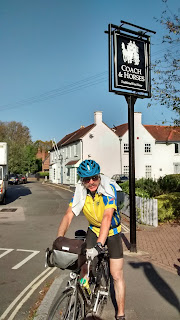
us, so it was a hungry peloton which wheeled into the Coach and Horses at 2pm.
The sun was warm in the garden, and food served quickly,
which helped us get back on the road just after 3.The route back was intended
to be quick, using the excellent A40 cycle track, a bit of Grand Union towpath,
and back roads to Osterley Park and Richmond Bridge by 4.30; the only hazard being the
unusually high tide flooding the riverside.
Twelve stayed to soak up more sun
outside for tea.
Thanks to Ged for back marking, all the corner markers on a
twisty route, and Simon for photos.
Only 33.5 miles, though the gravel made it feel like more,
11.1 mph moving, and a massive 940ft of climbing.


2 comments:
Hi Dave, glad to see that you all had a good ride barring the punctures etc. You certainly made the most of the tracks as I found out on Tuesday, if it hadn't been for the 4 Garmin failures I think I might have been quicker, but like you arrived about 2.00.
An interesting ride many thanks
Was it a coincidence that one of the punctures was just after Thorney? I think not...
Post a Comment