I did this ride in February, but it
took Ged’s erudite historical tour of Wandsworth to prompt me to shake off
lockdown lethargy and write it up. The idea was prompted by a ride I organised in 2010
around the borders of Merton to help a Kingston rider, Bryony Evens whose ambition
was to ride the perimeter of all 33 London boroughs that year. She enlisted the
help of LCC local groups, which is how I got involved for Merton. You can read
about her mammoth cycling challenge here, and even ride some of her gpx routes.
In this age of staying local, confining myself to Merton didn’t offer much. I
can cycle to the border in 15 minutes in any direction other than due south, so
a border ride offered a little distance, and some variety from familiar streets.
The “rules” were to stay as close to the border as practical, though this could
include riding on neighbouring borough roads
Even so it’s only around 21 miles around, but there is lots of potential for offroad,
and more challenging than you might think. Merton’s boundaries are mostly away
from urban centres, and on my 2010 ride I found places I hardly knew existed. The
borough’s two ancient communities, Wimbledon and Mitcham have extensive common
land at their peripheries, and even a recent suburban development like Morden
has retained ancient field paths to explore.
I deliberately chose a day during the cold weather when the muddy paths were frozen hard, which mostly worked out though there were a couple of icy patches to walk, and one swamp to wade through, on Mitcham common. Luckily my Northwave waterproof boots did what they said on the label.
I was interested to see how riding conditions had changed since 2010. Some has improved. For example, the romantically named Pig Farm Alley on the Sutton side of the border, once a rough track at best, is now delightfully wide, smooth and surfaced, and a home to constantly changing graffiti art.
Together with new paths on Merton’s side they now form a well-connected through route, though some with long memories regret the permanent loss of the link to Garth Road.
By contrast Mitcham is a mixed bag. Cycling is permitted on Mitcham Common, though hardly encouraged.
But once over the barriers there is some nice cycling, especially alongside the former Beddington Lane sewage plant.
In 2010 this was a site of post-apocalyptic dereliction. If Andrei Tarkovsky had filmed Stalker in England, this is where he would have chosen. Now is home to the Veolia incinerator; looks impressive from a distance, though some would question the wisdom of burning four boroughs’ domestic rubbish so close to so many homes. Still there are landscaped lagoons popular with wildfowl, and presently home to a white stork, according to a local birdwatcher I met.
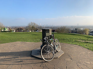
Pollards Hill is next, technically within Croydon, but with extensive views over Merton, so it’s on route. Originally the site of a prehistoric hill fort, the outline of which can clearly be seen. Today it’s a park, and the locals have put up an orientation plaque suggesting views as far away as Brighton Pier. With luck you could probably see Gatwick airport, a delight not available to prehistoric folk, but not today, so time to move on.
On a clear day you can see Brighton Pier
We are now into Wandsworth borders, Ged’s territory. I’m afraid I missed the historical significance of Roe Bridge, but I recall there was an old-fashioned cycle shop where I bought my first cycling shoes. The shop is now long gone, another piece of history. From here I was aware that we were following not just the border but also the ancient River Graveney, probably more blogged about recently than at any time since the Middle Ages.
I followed the Graveney as far as the Wandle, briefly on the Wandle Trail, before veering off on Mead Path. This is an ancient path, formerly the route of the Surrey Iron railway on its way to Wandsworth. Before the Wandle Trail was built in the 1980’s this was the path to Colliers Wood, and very wild it was too. I avoided it in 2010, even though it was on the border, but it’s now been nicely resurfaced.
Mead Path
It’s straightforward cycling from here to Earlsfield and up to Wimbledon Common. It is difficult to follow the border on the Common, cycling off the permitted paths is actively discouraged by the patrolling rangers. I chose the grandly named “Robin Hood Road” described by Bryony in 2010 as “a most hairy and skiddy descent” but in the recent freezing conditions, quite benign.
The border beyond follows the Beverley Brook, but it’s not easy cycling so I followed a more prosaic parallel on the A3 path. Not much scenically but it does get you home in time for tea on a freezing cold day.


3 comments:
Fascinating Dave. I liked the comparison with 10years ago. Can't say I'll copy you on that one!
How easy would it be to follow a Surrey borough boundary - compared to a London borough. Any Wayfarers up for the challenge?
Well Mole Valley would either be all familiar roads or some serious mountain biking. Elmbridge might have some potential - at least the Thames stretch would be relatively easy.
Or we could follow the Coal Tax posts - 60+ in Surrey alone and apparently over 200 still standing around London in total. Now there's a challenge. Quite a bit of offroad if the Surrey section is anything to go by.
Reigate and Banstead looks like a goer. It would be hard to do it exactly, with some tricky off-road and riparian boundaries at Shag Brook and the Mole. But a reasonable approximation is quite possible, about 42 miles.
I'd given Coals Posts some thought myself, but there are a lot of them, many of which are quite deep in the woods, as Brian says.
Post a Comment