Well, Brian, that was a pretty good find. I rode the route this morning and enjoyed it very much. I started at Denbies, not least because of their very positive attitude to using their land for recreation during the pandemic, and set off across the vineyards, a pleasure in itself.
The route is well signposted at this end, and uses the tracks constructed to allow access for vine-tending machinery. It leads generally South, passing through a new piece of vineyard, with a new track, which conveniently links to the bridleway down from Ranmore and joins the old Coach Road to pass under the Ranmore Road.
Steadily downhill from here, on farm tracks, a short stretch of NCN 22 and then across the A25 to begin the climb up Wolvens Lane. This is a very pretty stretch, and the route is signposted and well maintained. I was a little leery of Wolvens Lane, as my recollection of it goes back about 30 years when it was popular with the 4x4 crowd and was often no more than a muddy ditch. It's much better now. The first part is surfaced and gravelled, just like the route though Denbies, and the handy signs continue. After a mile or so there is a steep hill, not surfaced, with some tree-root steps. It was OK on the e-bike, which has a lot of power and some pretty trick traction control software. With a road bike, I think it would be a walk.
From the top, the track is not so good. It is partially gravelled, and there are a couple of lengthy sandy sections. I don't know if these are naturally occurring or are the foundations for work yet to be done. I rode them; if you had narrower tyres these would be a walk, too.
The signs and improved surface end at about this point. I don't know why, perhaps the development of the track is still in progress, or perhaps the money has run out. Anyway, it's perfectly rideable, and you're soon at Coldharbour.
I made a mistake here. The leaflet for the route directs you up past the cricket pitch and on to the top of Leith Hill from the East. As several Wayfarers have remarked, this is not an excellent route to descend, and it's considerably less excellent to ascend. The last climb is very steep, rocky and difficult. I rode it, but wouldn't again. A far better way for most Wayfarers would be to ride around the base of the hill from Coldharbour to Starveall, and to ride up the much easier route from the West. My gpx, which can be downloaded here, shows this route. While I'm at it, the leaflet for the Greenway can be downloaded here.
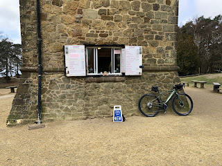
It's a few yards from the top of the rocky stretch to the Tower, coffee and views.
I went on from Leith Hill to Holmbury Hill and rode around the woods for a bit, before being chased back to Denbies by a shower. But I had a very good morning's riding, almost none of it on the road, and I now have a new link in the chain of routes along the Downs.
Thanks again, Brian.
Mark


1 comment:
Well that was quick! Light the blue touchpaper and off you go. Nice to hear that it's mostly in fairly good condition. I agree that the last 200m to the tower is hardly "accessible" though we did see two youngsters tackle it it at speed on e-MTBs last time we walked up. Well done - glad you enjoyed it.
Post a Comment